Search
 
 
  ISRO
WWW


Launch Date
05.05.2005
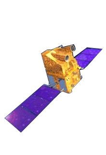
CARTOSAT – 1 is the first Indian Remote Sensing Satellite capable of providing in-orbit stereo images. The images are used for Cartographic applications meeting the global requirements. Cameras of this satellite have a resolution of 2.5m (can distinguish a small car).

The Cartosat – 1 provides stereo pairs required for generating Digital Elevation Models, Ortho Image products, and Value added products for various applications of Geographical Information System (GIS).
 
Launch date 5 May 2005
Launch site SHAR Centre Sriharikota India
Launch vehicle PSLV- C6
Orbit 618 km Polar Sun Synchronous
Payloads PAN FORE, PAN - AFT
Orbit Period 97 min
Number of Orbits Per day 14
Local time of equator crossing 10:30 am
Repetivity 126 days
Revisit 5 days
Lift-Off mass 1560 kg
Attitude and orbit control 3-axis body stabillised using reaction wheels, Magnetic Torquers and Hydrazine Thrusters
Electrical power 15 sqm Solar Array generating 1100w,
Two 24 Ah Ni-Cd batteries
Mission life 5 years
Home  |  About Us  |  ISRO Centers   |  Launch Vehicles  |  Satellites  |  Ground Facilities  |  Our Chairman
Sitemap  |  FAQ   |  Feedback  |  Terms of Use  |  Privacy Policy  |  Contact Us  |  Disclaimer
Copyright 2008 ISRO, All Rights Reserved.
 
Best viewed with a resolution of 1024x768 with Internet Explorer 7.0